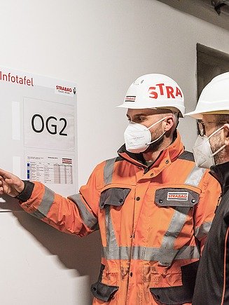
BIM2field in Brandýs

At a BIM2Field project in the Czech town of Brandýs nad Labem, the smartphone was the most important digital tool for our model-based work management on the construction site. Using an augmented reality (AR) layer, we overlaid the 3D information from the BIM model (Building Information Modelling) directly onto the natural landscape. This not only made it easier to check the construction progress and plan the next steps, it also saved a lot of paper!

Have you ever used your smartphone with an AR application? For our staff working in Brandýs nad Labem, Czech Republic, AR-enhanced building quickly became a routine on the construction site. For the work on a 4 km long bypass road, our colleagues used an AR layer on their smartphones, placed directly from the BIM model onto the natural landscape in a 3D view. The advantages: a constant flow of information, more planning quality through integrated planning, and the elimination of countless complex 2D paper construction plans. With BIM2Field, STRABAG’s construction sites are becoming paper-free and more sustainable as a result.

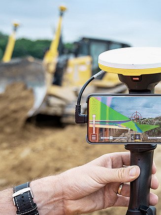
A match made in heaven: the combination of smartphone and GPS antennas makes all the difference!
With a few attachable accessories, the smartphone becomes a veritable jack-of-all-trades. As the smartphone’s integrated GPS receiver does not provide sufficiently accurate data, an additional GPS antenna is attached to the mobile device. The antenna allows our colleagues to precisely localise their position on the construction site and to feed their location data back into the digital model. This enables us to carry out reliable surveys without the need for bulky equipment and in a shorter amount of time. Precise, fast and to the point!
Uploading the construction site to the cloud
With BIM2Field, the construction site has an impact far beyond the actual location of the project. The digital tools collect a variety of digital data in a cloud-based data environment that can be accessed by all project participants. The important thing is to standardise the data so it can be accessed and used by people and machines, for example by the construction equipment controlled by the BIM data on site. With BIM2Field, we are taking another logical step towards digitalising the construction site – improving the flow of information, speeding up the processes and making the work more efficient overall.
Factsheet:

BIM2Field in Brandýs - the digital construction site